|
2015 - Itinerary
The maps indicated below show each day’s route.
A PNG map provides a quick visual overview, while
a Google Earth KMZ map allows an in-depth and interactive view.
Download a GPX map to your GPS device in order to
locate and travel the selected route.
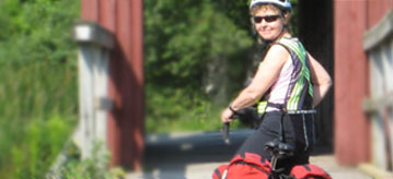
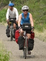
Rally.
For the time and location of events and meetings, consult
the schedule.
|
2015 - Itinéraire
Les cartes se trouvant ci-dessous tracent l’itinéraire parcouru chaque jour.
Une carte PNG offre un aperçu rapide, tandis qu’une carte KMZ de
Google Earth permet un examen interactif en profondeur.
Téléchargez une carte GPX dans votre appareil GPS afin de localiser
et parcourir le trajet choisi.
Rassemblement.
Pour connaître l’heure et le lieu des rencontres et événements,
consultez
l'horaire.
|
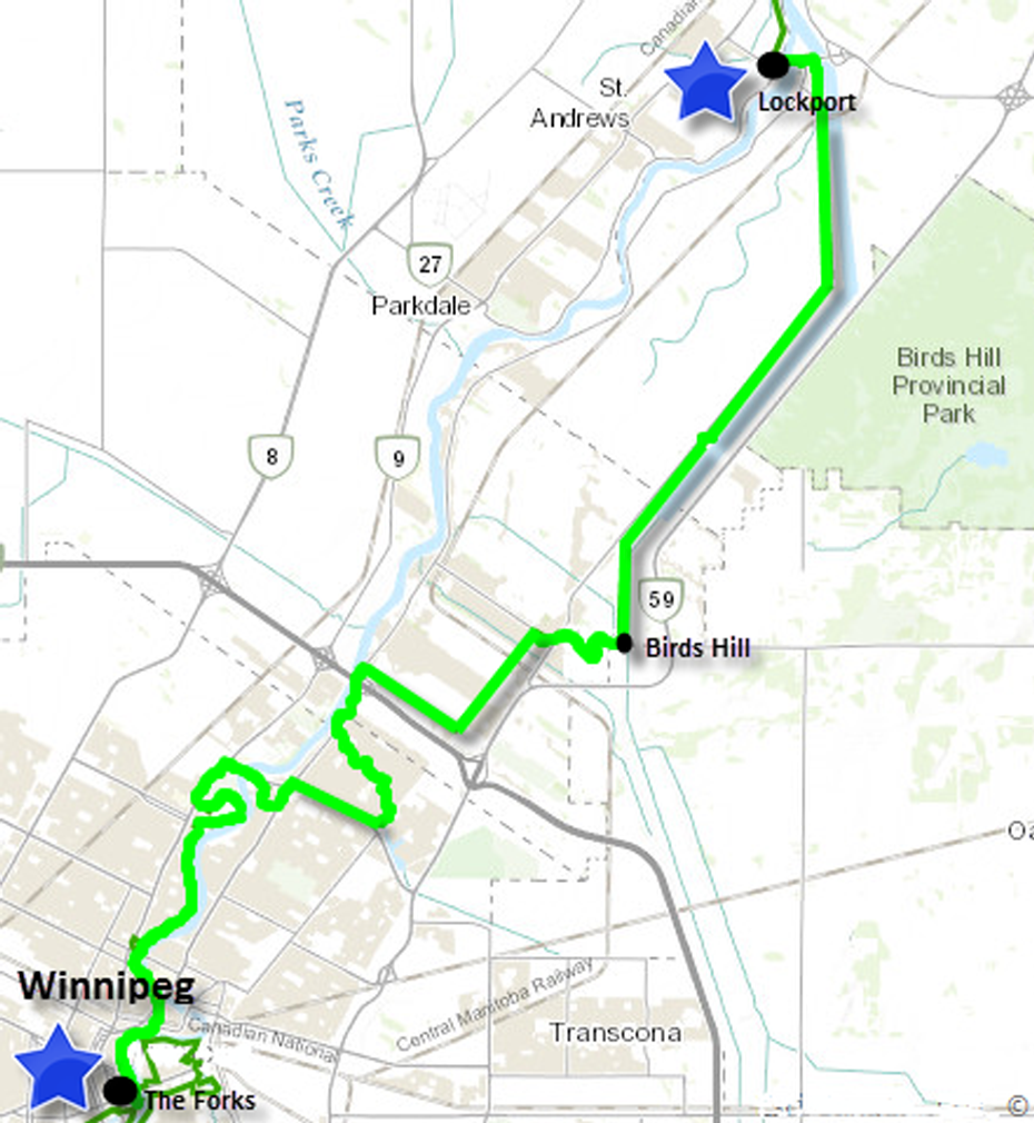
2015-07-05, Sunday/dimanche:
Winnipeg – Lockport – 44 km
PNG Map
KMZ Map
GPX Map
2015-07-06, Monday/lundi:
Lockport – Mars Hill – 63 km
PNG Map
KMZ Map
GPX Map
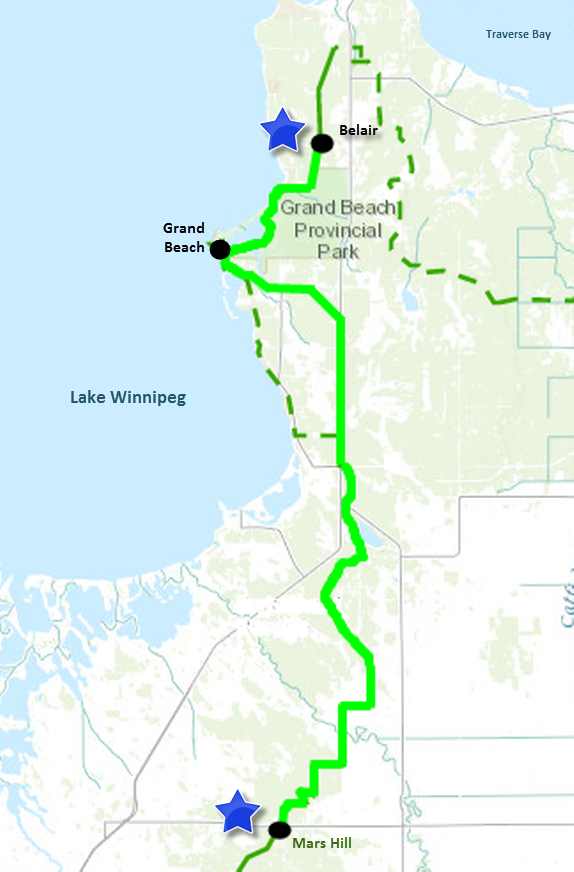
2015-07-07, Tuesday/mardi:
Mars Hill – Belair – 54 km
PNG Map
KMZ Map
GPX Map
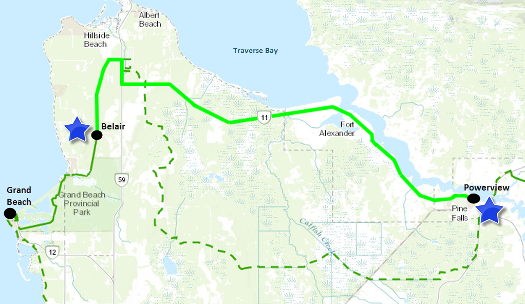
2015-07-08, Wednesday/mercredi:
Belair – Powerview – 36 km
PNG Map
KMZ Map
GPX Map
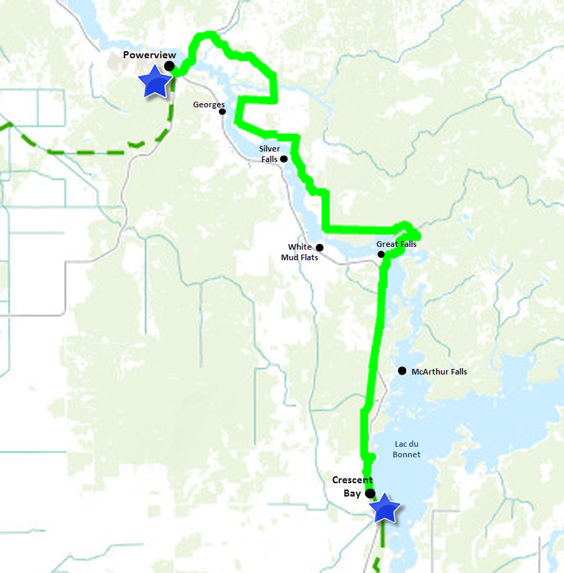
2015-07-09, Thursday/jeudi: Powerview
– Crescent Bay – 46 km
PNG Map
KMZ Map
GPX Map
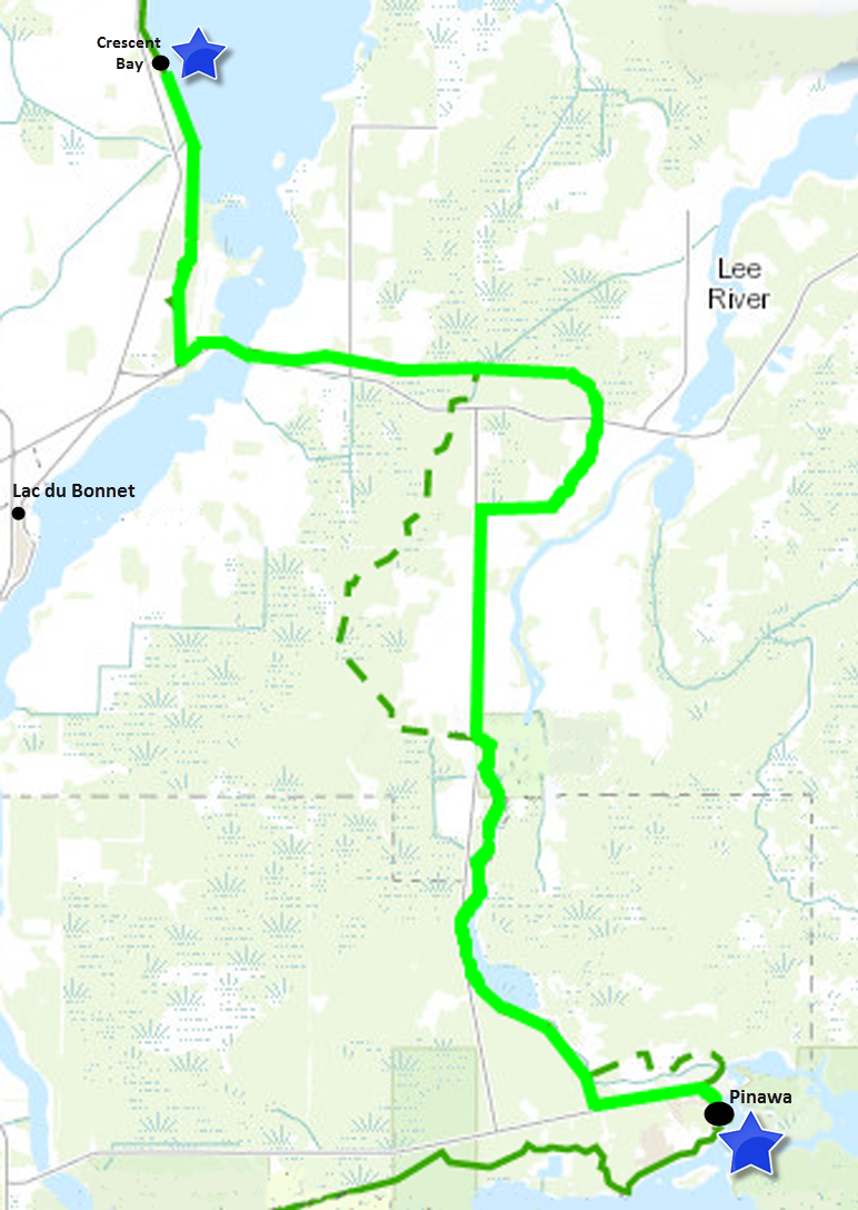
2015-07-12, Sunday/dimanche:
Crescent Bay – Pinawa – 37 km
PNG Map
KMZ Map
GPX Map
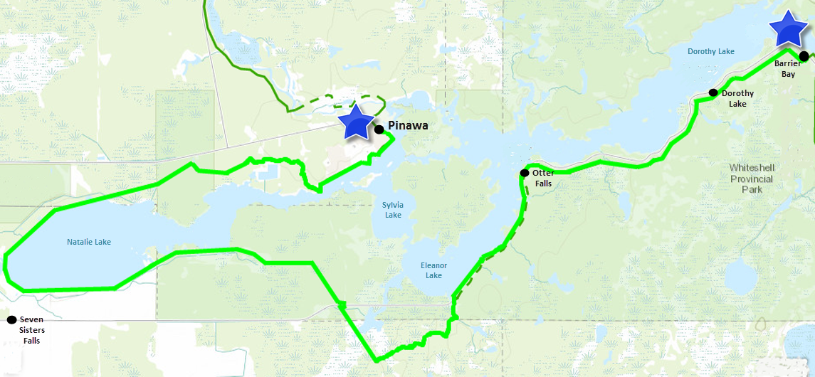
2015-07-13, Monday/lundi:
Pinawa – Barrier Bay – 45 km
PNG Map
KMZ Map
GPX Map
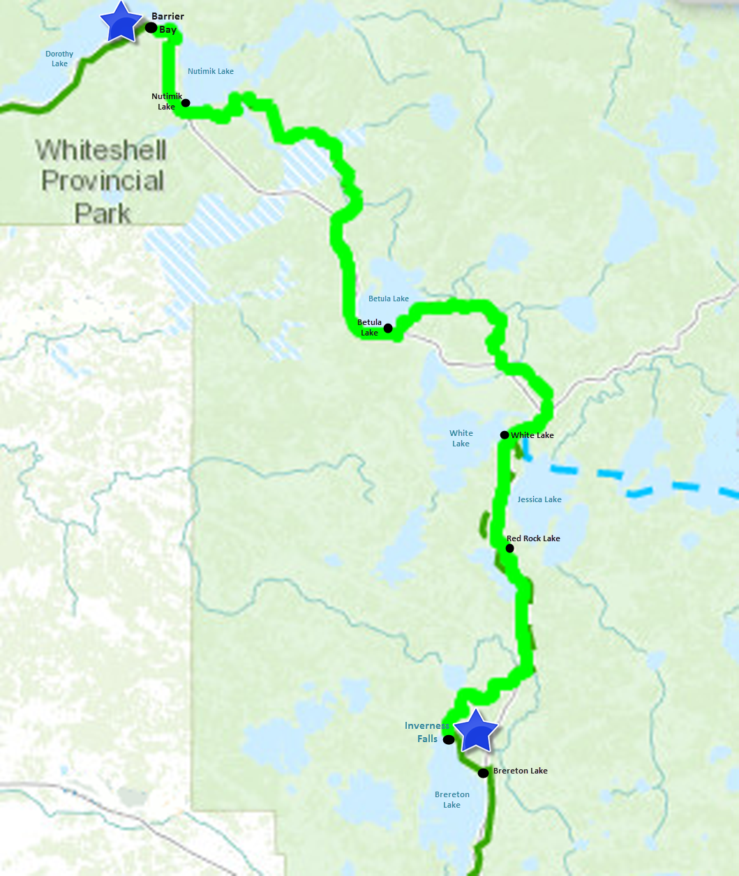
2015-07-14, Tuesday/mardi:
Barrier Bay – Inverness Falls – 49 km
PNG Map
KMZ Map
GPX Map
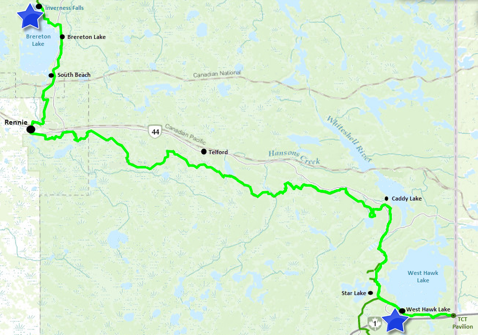
2015-07-15, Wednesday/mercredi:
Inverness Falls – West Hawk Lake – 61 km
PNG Map
KMZ Map
GPX Map
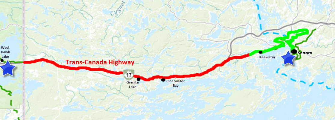
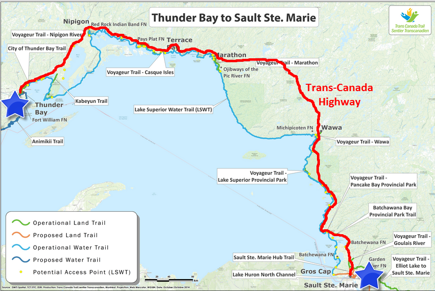
Note: There is no land trail linking the Ontario
communities of Kenora, Thunder Bay and Sault-Ste-Marie. /Aucun sentier ne relie Kenora à
Thunder Bay ou Sault-Ste-Marie.
2015-07-17, Friday/vendredi:
West Hawk Lake – Kenora
PNG Map
2015-07-20, Monday/lundi:
Kenora – Thunder Bay
PNG Map
2015-07-23, Thursday/jeudi:
Thunder Bay – Sault-Ste-Marie
PNG Map

